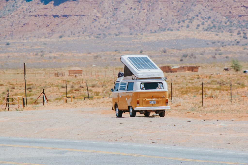
Traveling across Arizona with a camper rewards anyone willing to cover long distances and shift between deserts, forests, and high plateaus. The state’s roads cut through landscapes that change quickly, and those transitions shape how camper trips unfold. A traveler might wake to red cliffs in Sedona, drive two hours, and end up under tall pines near Flagstaff. The variety helps break long routes into manageable sections and gives each day a distinct purpose.
Understanding this variety helps plan better. Arizona is not a uniform desert. The south leans warm and dry for most of the year. The center mixes red rocks with shaded canyons. The north rises into cooler elevations where snow appears in winter. A camper traveler who knows these differences can choose roads based on weather, parking availability, and the type of scenery that suits the moment.
Arizona’s Seasons Matter More When Traveling by Camper
Seasonal timing shapes nearly every decision, from the route to where you stop at night. Arizona’s winters draw travelers toward low-elevation regions. Phoenix, Scottsdale, Tucson, Ajo, and Organ Pipe Cactus National Monument offer mild days and crisp nights. Campgrounds fill early, but the weather stays comfortable enough for longer stays. The desert light during December and January can feel sharp and clean, and roads rarely close.
Spring and fall offer the broadest range of options. March brings a mix of wildflowers in the Sonoran desert, warm days in Sedona, and still-cool temperatures in the north. Many travelers time their visits to avoid the summer spike and the winter crowds. Sedona’s Bell Rock and Cathedral Rock trails stay busy, but parking turnover keeps movement steady.
Summer requires the most planning. Temperatures near Phoenix and Tucson climb well past safe daytime levels. Travelers who want to stay inside a camper during the day risk uncomfortable interior heat without electrical hookups. Instead, most head north toward Flagstaff, Williams, the Mogollon Rim, and Page. Elevation makes a difference. Flagstaff sits at roughly 7,000 feet, so nights stay cool and days rarely reach the extremes of the southern desert.
Monsoon season adds another layer of complexity. July through September brings afternoon storms, short bursts of strong rain, and occasional flash floods in slot canyon areas. Roads in remote regions can turn soft quickly, especially in clay-heavy sections near Cottonwood or Rim Road 300. Travelers check forecasts daily before committing to dirt roads.
Fall tends to be the most stable and predictable period. Cottonwood trees change color in Oak Creek Canyon, temperatures cool enough for longer hikes, and national forests allow dispersed camping with fewer restrictions than busy summer months. Many long-distance travelers choose September through November for the widest range of comfortable stopping points.
Key Routes and How They Shape the Trip
Arizona’s highways create a natural structure for camper travel. I-17 links Phoenix with Sedona and Flagstaff. The drive climbs steadily, moving from desert heat to mountain air within two hours. US-89 connects Flagstaff to Page and the Utah border, opening access to Navajo Nation, Glen Canyon, and Vermilion Cliffs. I-40 cuts east-west across the state, linking small towns, forested sections, and historic stops along old Route 66.
Shorter scenic routes add character to the journey. Oak Creek Canyon on AZ-89A offers a tight, winding road with high canyon walls and a creek that weaves close to the pavement. The road moves from shaded forest segments to sudden red rock views near Sedona. Travelers should watch for parking limits along pullouts and arrive early at Slide Rock State Park during peak months.
The drive from Monument Valley to Page offers long, open views and several marked pullouts approved for short stops. This route allows easy access to iconic landmarks without forcing complex detours. Drivers who prefer less traffic choose early morning departures.
South of Phoenix, Highway 79 and Highway 77 offer quick access to state parks, mining towns, and quiet desert stretches. The road between Oracle and Globe gives space for slower driving and frequent viewpoints.
The Apache Trail, though partly unpaved and occasionally restricted after storm damage, remains one of Arizona’s most striking drives. The section near Canyon Lake presents steep drops, narrow turns, and deep canyon views. Travelers in larger campers check current conditions before attempting it.
Places to Stay, Park, and Explore With a Camper
Sedona and Verde Valley
Sedona sits in a pocket where red rock formations rise suddenly from the landscape. The area offers both designated RV parks and wide stretches of national forest suitable for dispersed camping. Rancho Sedona RV Park provides direct access to Oak Creek and walkable proximity to Uptown. Dead Horse Ranch State Park in Cottonwood offers larger spaces, steady water access, and reliable shade.
Coconino National Forest’s dispersed camping areas near Forest Road 525 remain a popular budget-friendly choice. Travelers use these sites for their openness and distance from traffic noise. The road can grow busy during spring and fall, so the earlier you arrive, the easier it is to find level ground.
Popular activities include short hikes around Bell Rock and longer routes toward Boynton Canyon. Verde Canyon Railroad, based in nearby Clarkdale, operates scenic rail trips through river canyons and offers large parking areas suitable for campers during excursions.
Flagstaff and Northern Pines
Flagstaff’s elevation encourages cooler summer temperatures and draws many long-distance road travelers. Bonito Campground near Sunset Crater provides a clean, organized layout with access to paved trails and short drives to geological sites. Mormon Lake and its surrounding forest roads offer dispersed camping in shaded pine areas.
Nearby attractions include Walnut Canyon National Monument, where cliff dwellings sit along steep canyon walls. Meteor Crater sits east along I-40 and remains one of the most striking geological features in the state. Travelers who enjoy astronomy often stop at Lowell Observatory for nighttime viewing sessions.
Grand Canyon Regions
The Grand Canyon remains the most visited destination in the state, and parking rules vary by section. Trailer Village RV Park inside the South Rim provides full hookups and direct shuttle access to viewpoints. Desert View Campground offers a quieter experience, though without hookups. A walk from the campground to Desert View Watchtower gives one of the broadest views of the canyon.
The North Rim appeals to travelers who want fewer crowds and cooler temperatures. It opens seasonally, generally from mid-May to mid-October. The drive from Jacob Lake to the rim offers several forested pullouts where travelers stretch, re-organize gear, or take short walks.
Page and Lake Powell
Page sits near Lake Powell, Horseshoe Bend, and Antelope Canyon. Wahweap RV and Campground near the lake offers lake views, organized sites, and direct water access. Many travelers book kayaking tours into Antelope Canyon early in the morning to avoid crowds and midday heat.
Horseshoe Bend’s main parking area accommodates larger vehicles but fills quickly. Early arrival guarantees easier navigation through the lot. Navajo tour operators offer guided trips to slot canyon areas, which require permits.
Tucson and Southern Arizona
Southern Arizona features diverse landscapes, from saguaro-studded hills to high-elevation pine regions on Mount Lemmon. Gilbert Ray Campground sits within Tucson Mountain Park, a short drive from Saguaro National Park West. Its location provides quiet nights and easier access to sunset viewpoints.
Organ Pipe Cactus National Monument, near the Mexican border, offers a remote desert setting with well-maintained campgrounds. Travelers appreciate its designated scenic drive and isolated trails, which stay peaceful even during winter peaks.
Nearby attractions include Mission San Xavier del Bac, Arizona-Sonora Desert Museum, and Sabino Canyon. Each offers organized parking that accommodates medium-sized campers, though Sabino Canyon lots fill early.
Prescott, Jerome, and Cottonwood
Prescott offers mild summer weather and clear mountain air. White Spar Campground sits close to the city center, giving access to restaurants, trails, and small museums. Watson Lake and Prescott National Forest provide several day-use areas with defined camper spaces.
Jerome, a hillside mining town, offers steep roads and tighter parking conditions. Travelers usually park below the main streets and walk upward to restaurants, shops, and art studios. Cottonwood delivers easier navigation and consistent access to groceries, water refills, and quieter overnight stays.
Where to Eat During a Camper Trip Through Arizona
Food stops anchor road trips and shape the rhythm of each day. Arizona’s routes offer a mix of casual restaurants, breweries, old mining-town cafes, and roadside saloons.
Northern Arizona
Flagstaff offers reliable parking and an easy downtown layout. Diablo Burger has become a staple for travelers wanting quick meals before continuing north toward Page. The restaurant uses locally sourced beef and keeps its menu direct.
Grand Canyon Village provides standard dining options near trailheads. Canyon Café serves early breakfasts, which help travelers planning sunrise viewpoints or long hikes. Williams, along I-40, includes small diners with long operating hours for travelers arriving late.
Page offers several quick-service stops. BirdHouse serves chicken bowls and sandwiches with enough outdoor space for travelers who want fast meals before heading to the lake.
Sedona and Verde Valley
Sedona’s restaurants often sit near trailheads or scenic viewpoints. The Hideaway House provides Italian dishes with canyon-facing patios. Many travelers stop there after hikes in the lower canyon areas. Parking requires patience during peak months, but late-afternoon hours offer better availability.
Cottonwood’s Old Town district features Colt Grill, which focuses on smoked meats and casual seating. The district has larger parking lots, making it easier for campers to navigate. Side streets accommodate longer vehicles without blocking traffic.
Southern Arizona
Tucson holds deep culinary traditions. El Charro Café, known for carne seca and historical roots, draws both locals and travelers. Many drivers schedule meals there on days when they visit Saguaro National Park or the Pima Air & Space Museum.
Farther east, the small stop at Tortilla Flat near Canyon Lake offers a rustic saloon atmosphere and quick meals for travelers on scenic routes. Its interior decor includes thousands of signed dollar bills and wooden tables that feel older than many modern restaurant chairs, though the charm comes from its remote placement on the Apache Trail.
Breweries in Tucson and Flagstaff offer both indoor seating and shaded patios. These options help break long driving days without adding complex detours.
Camper Travel Basics in Arizona’s Climate and Terrain
Heat, altitude, and long distances shape how travelers prepare their vehicles. In southern Arizona, interior temperatures rise quickly, even before noon. Travelers often plan drives early in the morning or late in the day to avoid extended heat exposure. When hookups are unavailable, shade and ventilation become essential.
Altitude affects both sleep and vehicle performance. In higher areas like Flagstaff or the North Rim, nights drop sharply. Travelers carry extra blankets or rely on heaters when temperatures dip near freezing. Fuel consumption also changes with elevation, so frequent top-offs help avoid unexpected shortages.
Water management becomes a priority in the desert. State parks, national forest day-use areas, and large travel centers like Love’s provide refill stations. Travelers heading to dispersed camping areas often fill tanks before leaving paved roads.
Dispersed camping rules vary slightly across forests, but most areas allow stays of up to 14 days. Campers avoid damaging vegetation by keeping vehicles on established surfaces. During dry months, fire restrictions often take effect, and travelers rely on propane stoves instead of open flames.
Safety considerations include wildlife awareness, especially in areas with active elk and deer populations near Flagstaff and Williams. Night driving raises the likelihood of encounters, so many choose daytime travel. Dust storms, known locally as haboobs, occasionally sweep across I-10 and I-8. During these events, drivers pull over, turn off lights, and wait for visibility to return.
Apps like Campendium, iOverlander, and Arizona DOT’s alerts help travelers track closures, dispersed camping areas, and real-time road conditions.
Hidden Corners Worth Exploring
Arizona holds several less-visited locations that reward travelers who have the time and willingness to reroute slightly.
Chiricahua National Monument in southeast Arizona features towering rock formations. Bonita Canyon Campground sits inside the park, offering shaded sites and walking access to several trailheads. The park remains quiet even during peak months.
The Mogollon Rim stretches across central Arizona and delivers cool breezes, thick forests, and wide views across the plateau. Rim Road 300 offers multiple dispersed sites with level ground and dramatic drop-off views. Summer travelers stop there for cooler nights.
Bisbee, a mining town near the southern border, offers narrow streets, coffee shops, and small galleries. Many travelers park on the edges of town and walk upward through historic districts. Its steep layout gives each street a viewpoint, and its creative local culture adds variety to a long road trip.
Lake Havasu City provides water activities, boating services, and RV resorts with direct lake access. The London Bridge area offers restaurants and long waterfront walks, making it a convenient day stop.
Kartchner Caverns State Park offers guided tours of limestone caves with preserved formations. The campground remains clean, quiet, and close to the visitor center. Many travelers stop here after leaving Tucson or before moving toward Bisbee or Tombstone.
A Practical Five-Day Arizona Camper Itinerary
A structured plan helps cover meaningful terrain without rushing.
Day 1: Phoenix to Sedona
Start early to avoid midday heat on I-17. Stop in Camp Verde for fuel or groceries. Settle into Dead Horse Ranch State Park or a dispersed site. Spend the afternoon on short hikes and get dinner in Cottonwood’s Old Town district.
Day 2: Sedona to Flagstaff
Drive north through Oak Creek Canyon, stopping at Slide Rock State Park when parking allows. Arrive in Flagstaff by early afternoon. Visit Walnut Canyon or Lowell Observatory before settling into camp near Sunset Crater.
Day 3: Flagstaff to Grand Canyon South Rim
Take US-180 or US-89 to the park. Park at Trailer Village or Desert View. Explore viewpoints along the rim and use the shuttle system to avoid moving the camper repeatedly.
Day 4: Grand Canyon to Page
Drive east along Desert View Drive and stop at the Watchtower. Continue toward Cameron Trading Post for a meal. Arrive in Page and settle at Wahweap. Visit Horseshoe Bend near sunset.
Day 5: Page to Monument Valley or Return South
Travel north to Monument Valley for a scenic loop or return toward Flagstaff for brewery stops, outdoor walks, and cooler evening temperatures before ending the trip.
Add-ons include Tucson and Saguaro National Park if heading south, or Prescott and Jerome if looping back through central Arizona. Each option builds on distinct landscapes and manageable distances.
Travel Tips That Make Arizona Camper Trips Smoother
Choosing the right vehicle size helps navigate Arizona’s varied roads. Oak Creek Canyon and Jerome’s streets challenge larger rigs, so mid-sized campers move with fewer restrictions. Planning daily mileage helps avoid late-night arrivals, especially in areas known for wildlife crossings.
Fuel and grocery stops often cluster around major towns. Stock up in Phoenix, Prescott, Flagstaff, or Page before heading into remote parks or national forests. Water refills remain essential on longer dispersed stays.
Weather changes quickly, so daily checks help avoid surprise closures. High winds can make driving across I-40 tiring. Monsoon storms create short delays in slot canyon regions. Winter snow affects the North Rim, Flagstaff, and the White Mountains.
Travelers who split long drives into multiple segments generally enjoy the trip more. A short stop for food, a trail walk, or a viewpoint resets energy and keeps the trip balanced.